In order to build a baseline to track and measure fire related damage, RS Metrics acquired and analyzed 50 cm resolution satellite imagery collected after the fire was fully contained on Nov 25, 2018. The vast majority of the fire perimeter was captured with imagery from 11/25/18 with a small area on the west side from 12/19/18.
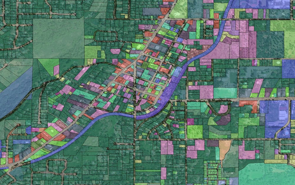

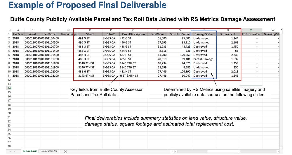
In addition to satellite imagery, parcel and tax roll data were sourced from the Butte County, CA Assessors Office. Metrics collected included square footage and assessed land and structure value of each home prior to it being destroyed. Approximately 18,265 parcels fell within the final fire perimeter and were therefore subject to analysis.
The process for generating the damage database is as follows:
- Determine the fire perimeter including specific municipalities or any residential properties that intersect a buffer of the fire boundaries.
- Acquire imagery as near as possible on or after Nov 25, 2018, including satellite imagery and aerial imagery available from the State of California or Butte County, CA.
- Obtain and purchase parcel and tax roll data from Butte County, CA with square footage, assessed value, address, and other information as needed.
- Determine the number of parcels required for analysis through a geospatial intersection.
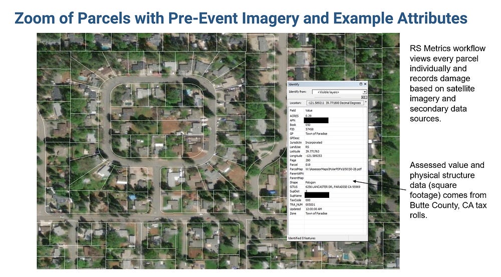
- Capture the following information for each parcel: 1) Street Address, 2) level of destruction at each property, coded as destroyed, partial damage, or undamaged, 3) Square footage of the parcel, property, and structure, 5) Assessed value of the land, parcel, property , and structure.
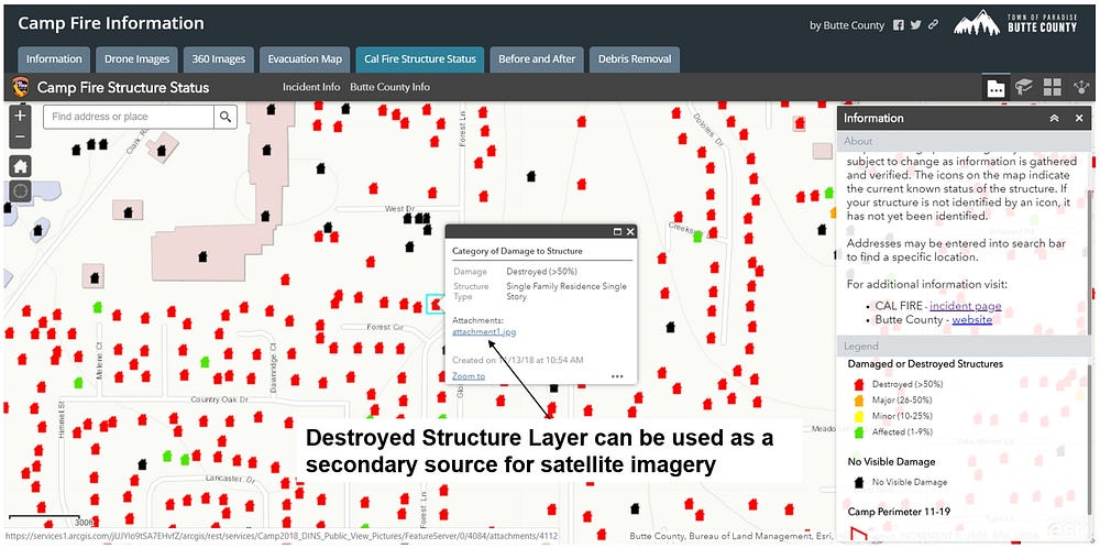
Data from public sources can be used to validate information collected through satellite imagery. Destroyed structure layers, addresses, aerial imagery, and ground level imagery can all be incorporated into a ensemble-based model.
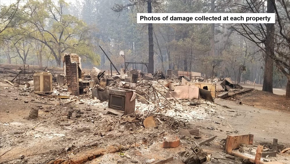
Ground level photos are used to visually verify structures that are obscured or not otherwise verifiable in satellite or aerial imagery. Distressing photos like these were captured by emergency authorities and contractors and become invaluable records for documenting the extent of the disaster in the years to come.
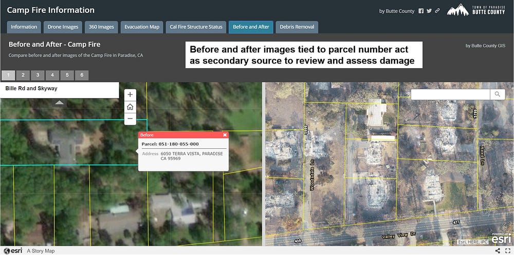
Additional tools are made available from government officials in Butte County and Cal Fire. In this instance before and after aerial imagery can be used as another secondary source to verify ground-level damage. RS Metrics uses “human-in-the-loop” machine learning processes to capture initial change detection features from before and after satellite imagery followed by human validation on a parcel-by-parcel basis.
Summary and Conclusion
Building a custom database allows participants of the CAT bond market to accurately assess and quantify damage on a parcel-by-parcel basis. This database can be used as a baseline to model risks associated with catastrophe bonds and Insurance Linked Securities overall. As these tools become more widely used not just for wildfire, but for any extraordinary event, sufficient levels of risk can be distributed through the entire financial system.