
We often get asked what the different options available for imagery are for our products and what the differences are. There are three primary sources of imagery that we use:
-
- Satellites (optical and radar/SAR)
- Aerial (airplanes)
- Drones
We balance the trade-offs between capability and cost when deciding which imagery source to use.
First, we consider resolution. High high resolution satellites get 35cm-1m resolution. Airplanes get 10cm-30cm. Drones get about 5cm (or better).
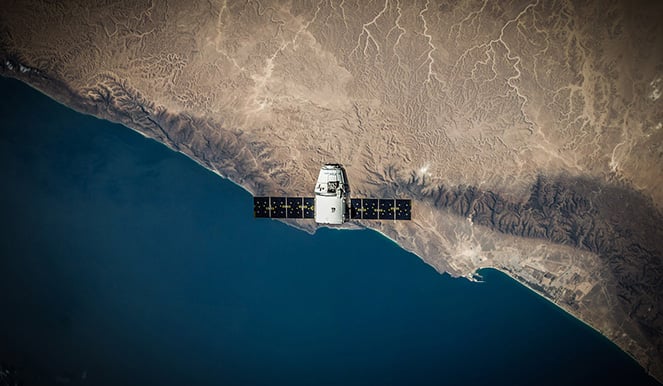
So, why use satellite imagery as the primary tool if it doesn't provide the best resolution? Because frequency of imagery collection is often just as important as resolution, and satellites are everywhere. Right now, imagery is collected by high resolution satellites over the populated ares on the surface of the earth about every week on average. Starting in 2020, there will be enough high resolution imagery satellites in orbit to image almost every point on earth every day. Within a few years of that, there will be enough satellites to image every point on the earth every few hours.
Many of the locations we track are remote - from smelters in Siberia to mines in the Congo - and planes and drones aren't always nearby, legal (especially for drones), or safe to fly in these areas. Satellites, however, regularly orbit overhead. Also, Satellites in orbit regularly take images without requiring that someone orders them ahead of time. This is a major advantage - when creating our datasets, we often need historical data to create our models and forecast for our clients.
So, what's the downside of relying on satellite imagery besides lower resolution? There are also time considerations - satellite imagery requires clear skies (or at least a hole in the clouds) and most are sun-synchronous and collect imagery from about 11 A.M. to 1:30 P.M locally. There are SAR (Synthetic Aperture Radar) satellites available that can take images at night and through cloud coverage. The resolution and frequency of revisit for SAR continues to improve, and is now starting to be more usable within our products.
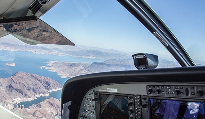
Aerial (airplane) imagery is another great tool. In the US and most of Europe, permission is not required to fly a plane over an area and collect imagery. In some countries, though, aerial imagery is difficult to get. For example, China requires a special permit to capture aerial imagery. Airplanes can capture imagery at any time day or night, and cloud coverage is also less of a concern. We can also revisit sites more frequently (especially intraday). One example is RS Metrics used aerial imagery when tracking construction progress on the Tesla gigafactory - to track progress and count traffic at the site.
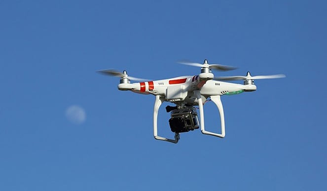
Drones are a great tool, but not yet legal everywhere. They boast great resolution (remember? 5cm or better), and can operate nearly any time of day. However, they're subject to many restrictions. They require permission from the property owner to fly over a property. We've done this when working with partners who want alternative data to verify other measurements - for example, we've been tasked to do headcounts at concerts to verify ticket receipts.
As you can imagine, getting permission from the landowner isn't always easy to obtain. However, there is an alternative in this case: in the absence of owner permission, you can get permission from an adjacent landowner to fly the drone over their land. While less than ideal, it can still give you valuable information.
Drones must also be flown within site of the operator to adhere to FAA regulation within the US.
Interested in learning more about RS Metrics? Please fill out the form below to let us know.